Things to do in Bangalore

Trekking

Night Trek

Camping

Parties

One Day Trips

Two Days Trip

Adventure

Workshop

Trekking

Camping

One & Two Day Trips

Adventure & Parties
Unveiling Agumbe Ghat: Karnataka's Scenic Gateway
Unveiling the Mystique of Agumbe Ghat: Exploring Karnataka's Rainforest Jewel
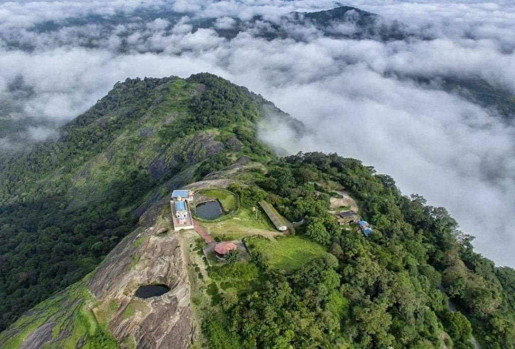
Nestled within the verdant embrace of Karnataka’s Shivamogga district lies the captivating Agumbe Rainforest Complex (ARC), a place of legendary allure, famed for its celestial downpours and lush biodiversity. Since the installation of the first rain gauge by the British in 1882, Agumbe has been etched in history books as the ‘Cherrapunji of the South’, renowned for its staggering annual rainfall exceeding 8,000 mm during the monsoon months.
Historical Rainfall Patterns and Modern Realities
Nestled within the verdant embrace of Karnataka’s Shivamogga district lies the captivating Agumbe Rainforest Complex (ARC), a place of legendary allure, famed for its celestial downpours and lush biodiversity. Since the installation of the first rain gauge by the British in 1882, Agumbe has been etched in history books as the ‘Cherrapunji of the South’, renowned for its staggering annual rainfall exceeding 8,000 mm during the monsoon months.
The distances from various cities to Agumbe by road
| From City | Distance (in km) |
|---|---|
| Mangalore | 110 |
| Shivamogga | 93 |
| Bangalore | 345 |
| Mysore | 277 |
| Hubballi | 268 |
| Hassan | 165 |
| Chikkamagaluru | 115 |
| Udupi | 62 |
| Thirthahalli | 32 |
| Jogfalls | 143 |
| Sakleshpura | 150 |
The Reign of Rain Gauges: Tracking Precipitation Trends
The installation of rain gauges across the Western Ghats has illuminated the true extent of rainfall distribution. Recent data reveals Agumbe’s slip to the third position in Karnataka’s rainfall hierarchy, with Nadpal and Hulikal surpassing its precipitation figures. The Karnataka State Natural Disaster Management Corporation (KSNDMC) projects further gauge installations to refine rainfall assessments in the forthcoming years.
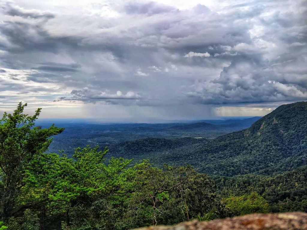
The Enigmatic Dance of Monsoon: A Meteorological Musing
Despite the India Meteorological Department’s (IMD) projections of augmented rainfall in the Western Ghats, the monsoon’s capricious nature has defied expectations. A prolonged hiatus in August left the region parched, with only 65% of the usual rainfall recorded. With the monsoon’s denouement imminent, prospects of fulfilling the deficit remain bleak, painting a somber picture of Agumbe’s climatic reality.
Unraveling the Tapestry of Agumbe's Ecological Symphony
Beyond its meteorological marvels, Agumbe unveils a tapestry of ecological wonders, serving as a crucible for biodiversity research and conservation efforts. The Agumbe Rainforest Research Station stands as a bastion of scientific inquiry, delving into monsoonal dynamics and its ramifications on the King Cobra’s habitat, the world’s only natural dwelling.
Embarking on an Odyssey of Discovery: Attractions and Adventures
Agumbe beckons intrepid souls to traverse its mist-laden trails and delve into its sylvan splendor. From the majestic Narasimha Parvatha to the ethereal allure of Kunchikal Falls, Agumbe offers a cornucopia of natural wonders. Trekking enthusiasts can immerse themselves in the embrace of dense forests, serenaded by the symphony of cascading waterfalls.
Navigating the Enchanting Hamlet: Practical Tips and Insights
For travelers embarking on a pilgrimage to Agumbe, strategic planning is paramount. The village’s proximity to Mangalore International Airport and well-connected roadways offer seamless access. Homestays such as Male mane farmstay and Nisarga Homestay provide cozy retreats amidst Agumbe’s emerald expanse, while local eateries offer delectable vegetarian fare.
Places to visit near Agumbe along with their respective distances from the village:
| Place | Distance from Agumbe (in km) |
|---|---|
| Sunset View Point | 2 |
| Agumbe Park With Lake | 2 |
| Kalinga Centre for Rainforest Ecology | 3 |
| Sri Venugopalakrishna Swami Temple | 1 |
| Green Point Agumbe | 3 |
| Barkana Falls View Point | 10 |
| Jogigundi Falls | 5 |
| Malgudi Days Shooting Spot | 1.5 |
| Onake Abbi Falls | 7 |
| Malgudi Days House Agumbe | N/A (Located in Agumbe) |
| Barkana Falls Top | 12 |

In Conclusion: A Journey Beyond the Horizon
As the sun sets over Agumbe’s emerald canopy, casting a golden hue upon the horizon, one is reminded of the timeless allure of nature’s sanctuaries. In Agumbe, amidst the symphony of raindrops and rustling leaves, humanity finds solace in the embrace of Mother Earth, a testament to the enduring majesty of Karnataka’s rainforest jewel.
Frequently Asked Questions for Hogenakkal Falls
Certainly! Here’s a Q&A format for Agumbe Ghat:
1. What is the total distance of Agumbe Ghat?
– Agumbe Ghat spans approximately 10 to 11 kilometers.
2. How many turns are there in Agumbe Ghat?
– Agumbe Ghat features 13 hairpin turns.
3. What does Agumbe Ghat connect between?
– Agumbe Ghat serves as a connecting route between Shivamogga district and Udupi district.
4. What is the current road condition of Agumbe Ghat?
– As of now, Agumbe Ghat’s road condition is precarious, and heavy vehicles are not permitted until September 15th.
5. Why is Agumbe famous?
– Agumbe is renowned for its mesmerizing sunsets, vibrant tourism, exhilarating trekking opportunities, captivating photography vistas, unique weather patterns, and its significance as a research hub for King Cobra and medicinal plants.
6. Which month is the best time to visit Agumbe?
– The monsoon and winter seasons, typically occurring between October to February, are considered the best months to experience Agumbe’s enchanting beauty.
7. Is Agumbe famous for sunset or sunrise?
– Agumbe is celebrated for its breathtaking sunset views.
8. In which district is Agumbe Ghat located?
– Agumbe Ghat is situated in the Shivamogga district, specifically within Thirthahalli taluk.
9. What is Agumbe also known as?
– Agumbe is often referred to as the “Cherrapunji of South India” due to its remarkable rainfall statistics and ecological richness.
Picks By Erica
Makalidurga Trek
Siddara Betta Trek
Handi Gundi Betta
- Skandagiri Trek
- Kumara Parvatha Trek
- Uttari Betta Trek
- Makalidurga Trek
- Tadiandamol Trek
- Ettina Bhuja Trek
- Nandi Hills Trek
- Mullayanagiri Trek
- Kunti Betta Trek
- Devarayanadurga Trek
- Madhugiri Trek
- Narasimha Parvatha Trek
- Pushpagiri Trek
- Kurinjal Trek
- Ombattu Gudda Trek
- Kabbaladurga Trek
- Siddara Betta Trek
- Bheemeshwari Trek
- Bandaje Arbi Falls Trek
- Jenukal Gudda Trek
- Bababudangiri Trek
- Ranganathaswamy Betta Trek
- Kumta Beach Trek
- Bananthimari Betta Trek
- Netravathi Trek
- Bidarakatte Trek
- Kote Betta Trek
- Rayakottai Trek
- Sharavathi Valley Trek
- Savandurga Trek
- Anthargange Trek
- Nishani Motte Trek
- Kodachadri Trek
- Kudremukh Trekking Adventure
- Nirvana Beach Camping
- Handi Gundi Betta Trek
- Sathodi Falls Karnataka
- Channagiri Betta Trek
- Gudibande Fort Trek
- Dudhsagar Falls Trek
- Bandaje Trek
- Kumaraparvata Trekking
- Ravugodlu Trek
- Mandalpatti Trek
- Z Point Trek
- Agumbe
- Ettina Bhuja
- Savandurga
- Shivagange
- Dudhsagar Falls
- Dudhsagar Falls
- Kodachadri
- Sirimane Falls
- Iruppu Falls
- Rayakottai
- Banasura Hill
- Netrani Island
- Netravati Peak
- Mullayanagiri
- Gokarna
- Dandeli
- Chikkamagaluru
- Coorg
- Bangalore
- Kemmangundi
- Karnataka India
- Mysore
- Sakleshpur
- Kotagiri
- Kollur
- Kumta
- Yana
- Devarayanadurga
- Hampi
- Mandalpatti Peak
- Madhugiri Hill
- Avani Betta
- Didupe
- Kumara Parvatha
- Shimoga
- Ermayi Falls
- Manchabele Reservoir
- Bheemeshwari
- Kaiwara
- Kodaikanal Falls
- Murkannu Gudda
- Surla Waterfalls
- Kavaledurga Fort
- Kemmangundi
- Magod Falls
- Jog Falls
- Kanva Dam
- Pandavara Betta
- Ramadevara Betta
- Bhuvanagari Fort
- Athirapally Waterfalls
- Muthati
- Kunthi Hills
- Cubbon Park
- Bannerghatta Biological Park
- Innovative Film City
- Bull Temple
- Murudeshwar
- Markonahalli Dam
- Janapada Loka
- Mallalli Falls
- Devaramane Viewpoint
- Kalasa
- Nagarhole National Park
- Talakadu
- Gangadikal Peak
- Chunchi Falls
- Channagiri Hills
- Horagina Betta
- Kyatanamakki
- Bheemana Kindi
- Muregar Falls
- Devimane Ghat
- Gudavi Bird Sanctuary
- Agni Gudda
- Kurinjal Peak
- Apsarakonda Falls
- Belur And Halebidu
- Soormane Falls
- Srirangapatna Temple
- Hampi Trek
- Dandeli Falls
- Wayanad Trek
- Chikmagalur Hills
- Agumbe Falls
- Paithalmala
- Bangalore Palace
- Mashobra Hills
- Night Camping
- Kaveri Nisargadhama
- Unchalli Falls
- Sakleshpur Falls
- Chikmagalur Trekking Places
- Kaginahare
- Rani Jhari
- Abbey Falls
- Kudremukh National Park
- Bannerghatta National Park
- Nijagal Betta
- Madikeri Fort
- Hidlumane Falls
- Iruppu Falls
- Belkal Theertha Falls
- Devarayanadurga Betta
- Gopalaswamy Betta
- Devarayanadurga Fort
- Hebbe Waterfalls
- Kid Friendly Places Near Bangalore
- Camping Near Bangalore
- Two Day Trip From Bangalore
- Weekend Outing In Bangalore
- Trekking Near Bangalore
- One Day Trip Near Bangalore
- Parties In Bangalore
- Trekking Packages
- Night Trek Bangalore
- Treks Near Bangalore
- Night Trekking In Bangalore
- Weekend Getaways From Bangalore
- Bangalore To Coorg Package
- Best Tourist Places In Kerala
- Team Outing Near Bangalore
- One-Day Road Trips From Bangalore By Car
- Ettina Bhuja Distance From Bangalore
- Hill Stations Near Banaglore
- One Day Trek
- Trekking Near Myosre
- Waterfalls Near Bangalore
- Picnic Spots Near Bangalore
- Top Tourist Places In Bangalore
- Trekking In Bangalore
- Chikmagalur Trekking Packages
- Bangalore To Hampi Distance
- New Year Events In Bangalore
- Sunrise Trek Near Bangalore
- Places To Visit In Madikeri In 2 Days
- Go Karting In Bangalore
- Trampoline Park Bangalore
- Best Street Food In Bangalore
- Places To Visit In Tumkur
- Agumbe Tourist Places
- Best Beach In Gokarna
- Kanakapura Waterfalls
- Sunrise At Nandi Hills
- Uttari Betta Trek Location
- Bangalore To Gokarna
- Bangalore To Coorg
- Bangalore To Ooty
- Nandi Hills Tent Stay
- Dandeli Trekking
- Murudeshwar Sightseeing
- Waterfalls In Udupi
- Solo Travel
- Adventure
- Beautiful Places To Visit In India
- Kolukkumalai Sunrise
- Mysore Trip
- Coorg Waterfalls
- Chikmagalur Hill
- White Hills Bangalore
- Sholay Shooting Hill Top
- Activities To Do In Bangalore
- Night Camping
- Hills In Bangalore
- Places To Visit Near Adiyogi
- Trekking In Karnataka
- Agumbe Ghat
- Famous Places In Karnataka
- Highest Peak In Karnataka
- Hill Stations Near Bangalore
- Historical Places In Karnataka
- Bandipur Safari Timings
- Beaches Near Bangalore
- Chikmagalur Tourist Places
- Coorg Trekking
- Famous Temples In Bangalore
- Fun Activities In Bangalore
- Gokarna Main Beach
- Gokarna Trip
- Historical Places In Bangalore
- Picnic Spots In Bangalore
- Places Around Bangalore
- Places In Gokarna
- Places To Visit In Bangalore With Family
- Places To Visit In Chikmagalur
- Places To Visit In Gokarna
- Places To Visit In Honnavar
- Places To Visit In Shimoga
- Rock Climbing In Bangalore
- Sakleshpur Places
- Sakleshpur Tourist Places
- Sakleshpur Trek
- Shimoga Places To Visit
- National Parks In Karnataka
- Tourist Places In Karnataka
- Tourist Places Near Bangalore Within 100 Kms
- Traditional Food Of Karnataka
- Treks In Karnataka
- Sirsi Karnataka
- Coorg Falls
- Kunti Betta From Bangalore
- Kunti Betta Trek Distance
- Nature Places In Bangalore
- Mysore Tourist Places
- Muthanga Wildlife Safari
- Cities In Karnataka
- Coastal Karnataka
- Devarayanadurga Distance
- Places To Visit In Chikmagalur In 2 Days
- Places To Visit In Hassan
- Sangam Waterfalls
- Sangam Waterfalls
- Savandurga Trek Distance
- Skandagiri Trek Start Point
- Kodaikanal Tourist Places
- Bangalore To Munnar
- Bangalore To Hampi
- Bangalore To Coorg Distance
- Banglore To Ooty
- Bangalore To Sakleshpur
- Bangalore To Hogenakkal
- How To Reach Coorg
- Bangalore To Shivanasamudra
- Bangalore To Mysore
- Bangalore To Kodaikanal
- Bangalore To Kudremukh
- Bangalore To Chikmagalur Distance
- Bangalore To Shimoga
- Frequently Asked Questions - Munnar
- Frequently Asked Questions - Ooty
- Frequently Asked Questions - Dudhsagar
- Frequently Asked Questions - Dandeli
- Frequently Asked Questions - Chikmagalur
- Frequently Asked Questions - Coorg
- Frequently Asked Questions - Mysore
- Frequently Asked Questions - Alleppey
- Frequently Asked Questions - Bangalore
- Frequently Asked Questions - Bangalore
Host Events
Collaboration
Copyright © 2024 EventsErica


